Application of GIScience
Geographic Information Science encompasses the collection, managment and utilization of spatial data through techniques such as remote sensing and geographic information systems (GIS). MU Geographers use GIScience to approach a variety of problems, as represented by these topics and publications.
Readings
J.D. Harlan. and J.M. Denny. (2003) Atlas of Lewis and Clark in Missouri. Columbia: University of Missouri Press.
L.F. Elliott, D.D. Diamond, C.D. True, C.F. Blodgett, D. Pursell, D. German, and A. TreuerKuehn. (2014) Ecological System of Texas: Summary Report. Texas Parks & Wildlife Department, Austin, Texas.
C. Blodgett, R. Lea and D. Diamond. (2012) Ruffed Grouse Habitat Characterization Project Report. Final report to Missouri Department of Conservation.
C. Wang, J. Wu, Y. Zhang, G. Pan, J. Qi and W. A. Salas (2009) Characterizing L-band scattering of paddy rice in southeast China with Radiative Transfer Model and multitemporal ALOS/PALSAR imagery. IEEE Transactions on Geoscience and Remote Sensing. 47 (4): 988-998.
C. Wang, H.S. He, and J. M. Kabrick (2008). A risk rating study to predict oak decline and recovery in the Missouri Ozark Highlands, USA. GIScience and Remote Sensing, 45 (4): 406 – 425.
C. Wang. and J. Qi (2008) Biophysical estimation in tropical forests using JERS-1 VNIR and SAR imagery: I - leaf area index. International Journal of Remote Sensing, 29 (23), 6811 – 6826.
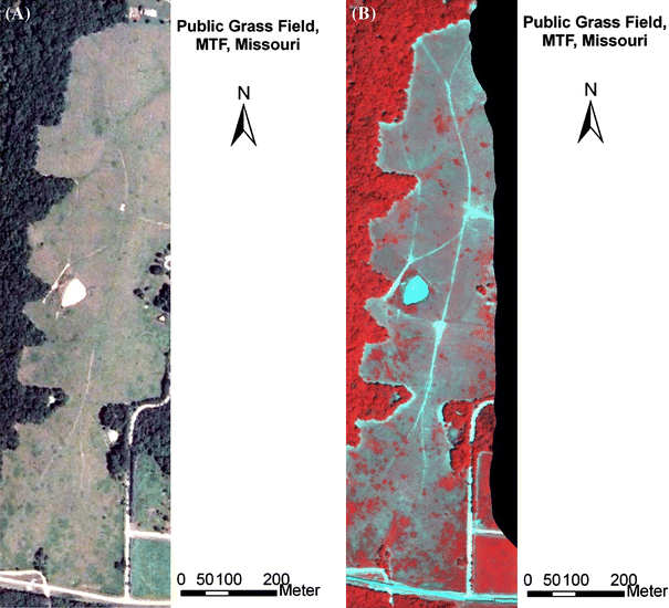
C. Wang, B. Zhou, and H. L. Palm (2008) Detecting invasive Sericea Lespedeza (Lespedeza cuneata) in Mid-Missouri pastureland using hyperspectral imagery, Environment Management, 41(6): 853-862.
C. Wang, J. Qi, S. Moran and R. Marsett. (2003) Soil Moisture Estimation in Semi-arid Rangeland Using ERS-2 and TM imagery Remote Sensing Environment 90: 178-189.
C. Wang, Z. Lu, and T. L. Haithcoat (2007) Using Landsat images to detect oak decline in the Mark Twain National Forest, Ozark Highlands. Forest Ecology and Management. 240, 70-78.
R.D. Lea. (2005) "A Comparison of Forest Change Detection Methods and Implications for Forest Management" Masters Thesis,University of Missouri.
B. Zhou. (2007) "Application of Hyperspectral Remote Sensing in Detecting and Mapping Sericea lespedeza in Missouri" Masters Thesis, University of Missouri.
T.C. Matisziw. and A.T. Murray. 2009. Area Coverage Maximization in Service Facility Siting. Journal of Geographical Systems 11(2), 175-189.
T.C. Matisziw. and A.T. Murray. 2009. Siting a Facility in Continuous Space to Maximize Coverage of a Region. Socio-Economic Planning Sciences. 43(2), 131-139.
T.C. Matisziw. and A.T. Murray. 2009. Connectivity Change in Habitat Networks. Landscape Ecology 24(1), 89-100.
A.T. Murray, T.C. Matisziw, H. Wei, and D. Tong. 2008. A GeoComputational Heuristic for Coverage Maximization in Service Facility Siting. Transactions in GIS 12(6), 757-773.
T.C. Matisziw. and A.T. Murray. 2006. Promoting Species Persistence Through Spatial Association Optimization in Nature Reserve Design. Journal of Geographical Systems 8(3), 289-305.
T.H. Grubesic, T.C. Matisziw, and M.A. Zook. 2009. Spatio-Temporal Fluctuations in Airline Network Hierarchies. Journal of Transport Geography 17(4), 264-275.
T.C. Matisziw, A.T. Murray, and T.H. Grubesic. 2009. Exploring the Vulnerability of Network Infrastructure to Interdiction. The Annals of Regional Science 43(2), 307-321.
T.C. Matisziw. and A.T. Murray. 2009. Modeling s-t Path Availability to Support Disaster Vulnerability Assessment of Network Infrastructure. Computers & Operations Research 36(1), 16-26.
T.H. Grubesic. and T.C. Matisziw. 2008. Prospects for Assessing and Managing Vulnerable Infrastructures: Policy and Practice. Growth & Change 39(4), 543-547.
A.T. Murray, T.C. Matisziw, and T.H. Grubesic. 2008. A Methodological Overview of Network Vulnerability Analysis. Growth & Change 39(4), 573-592.
T.H. Grubesic, T.C. Matisziw, and M. Zook. 2008. Cities and global airline network connectivity. GeoJournal 71(1), 53-66.
A.T. Murray, T.C. Matisziw, and T.H. Grubesic. 2007. Critical Network Infrastructure Analysis: Interdiction and System Flow. Journal of Geographical Systems 9(2), 103-117.
T.C. Matisziw, T.H. Grubesic, and H. Wei. 2008. Downscaling Spatial Structure for the Analysis of Epidemiological Data. Computers, Environment and Urban Systems 32(1), 81-93.
T.H. Grubesic. and T.C. Matisziw. 2006. On the Use of Zip Codes and Zip Code Tabulation Areas (ZCTAs) for the Spatial Analysis of Epidemiological Data. International Journal of Health Geographics 5(58).
T.C. Matisziw, A. T. Murray, and C. Kim. 2006. Strategic Route Extension in Transit Networks. European Journal of Operational Research. 171(2), 661-673.