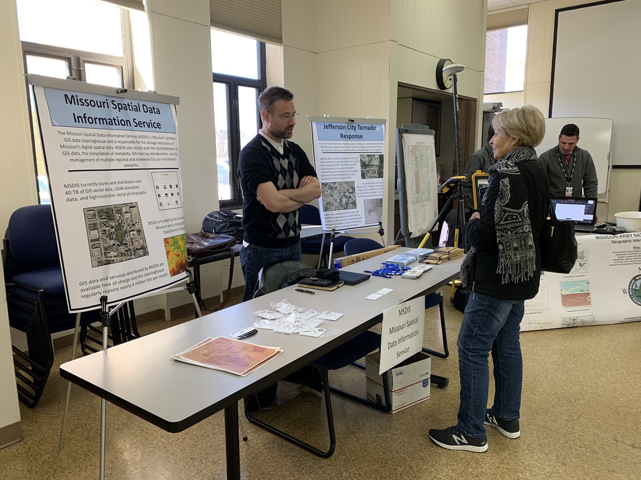
GIS Specialist Tom Vought staffs booth, answers questions, delights children
Geography’s Senior Geospatial Information Specialist Tom Vought recently participated in GIS Awareness Week by partaking in Mid-Missouri GIS Day on Nov. 13 in Jefferson City at the local police station.
He represented our geography department with a booth, along with other representatives from Cole County, Jefferson City, the Missouri National Guard, local fire and police departments, as well as private industry.
“Like the rest of the week, the day was meant to educate society about what GIS is and how it can be applied to everyday problems,” Vought says. “GIS, quickly, is a technology that uses digital spatial data to help analyze and solve problems.”
A classic example, he says, is finding a new route to work. One would use a digital layer of roads to analyze the path of shortest distance. “In other cases, people have called us interested in using aerial photography for house hunting.” He says GIS data can help individuals look at landscape, compare crime statistics, review school districts, etc., to find the best place for them to purchase or build their homes.
Nearly 75 attended the event — everyone from grade-school-age kids to adults of all ages. “Toward the end of the day, we were visited by 30-plus public-school kids who had spent the day learning about GIS,” he says. “And they had come to visit folks and talk one-on-one about how technology is used and to see examples.”
Vought says since they were at Jefferson City GIS Day, he focused on how technology was used to help first responders after the tornado in May 2019, which destroyed large sections of the area. “They didn’t ask a lot of questions,” he says. “But what I will say is when I spoke with them they had a lot of great ideas in what GIS is used for and were very interested in some of the high-resolution imagery we had displayed.
“The highlight of the day, other than talking to the kids, came earlier in the day when the first group of folks came by. Everyone had really phenomenal questions about GIS, what it is used for, how the data is collected, how the data is distributed …. It was a lot of fun talking about the technology and educating people about what we did with it and what MSDIS (Missouri Spatial Data Information Service) in particular does to help the Missouri GIS community.”
Vought says this was the first time he attended GIS Day in Jefferson City. He had previously participated in the City of Columbia GIS Day. “At that time, we talked about the Missouri Broadband Mapping Project that MSDIS and the Geography Resources Center were involved in,” he says. “Which was the Missouri portion of a national federally funded project. We were charged with mapping the availability of broadband throughout the state of Missouri.”
Vought says he hopes to participate in GIS Day next year: “It was a lot of fun. I’m definitely looking forward to doing something for the occasion again.”