Art and Argument: Indigenous Counter Mapping through Art and Oral Traditions

Black Goose Map

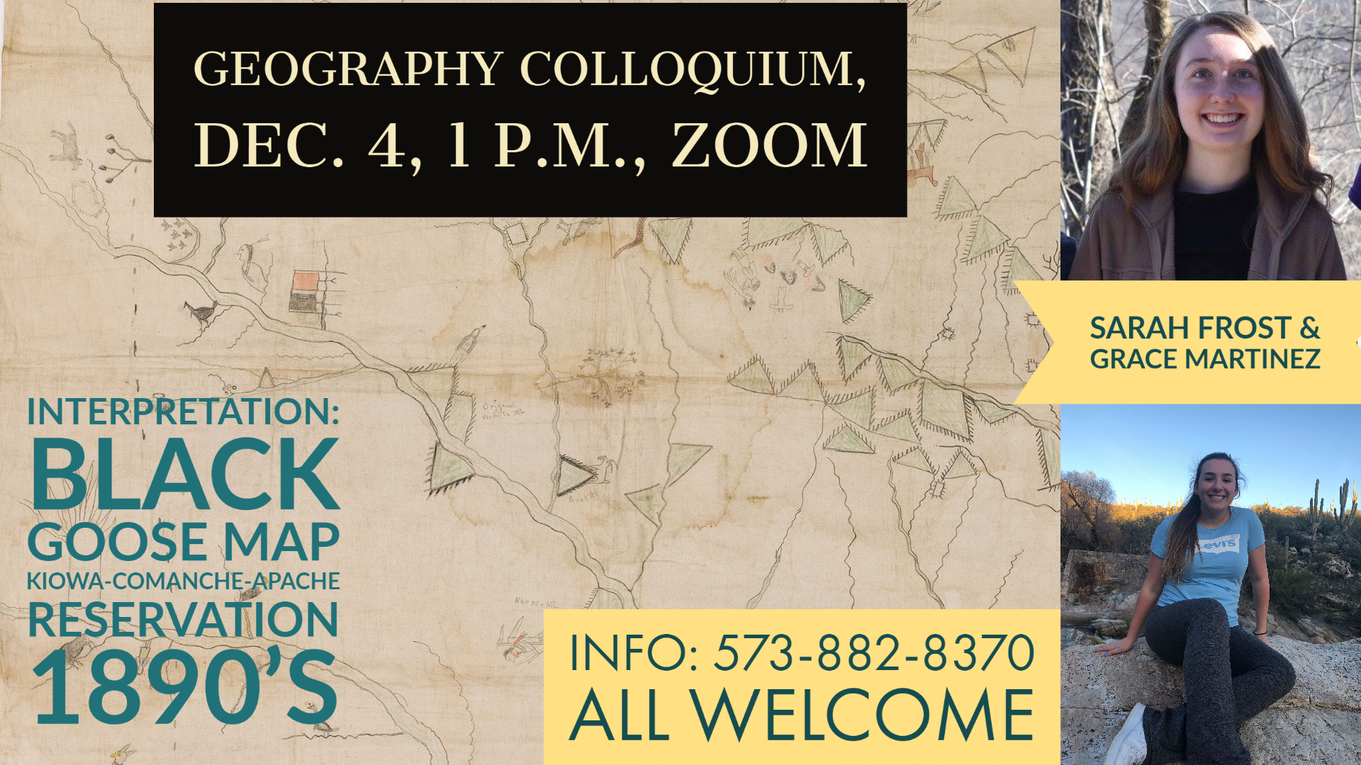
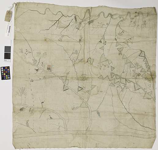
There once was a man named Black Goose who lived on the Kiowa-Comanche-Apache (KCA) Reservation in Oklahoma Territory. In the 1890s a group of US attorneys approached him to create a map of the KCA area, for use in legal disputes over the Texas border and KCA Reservation boundaries. His product, a colorful depiction of plains topography, is a rich display of Kiowa experience and history across the landscape.

Geography Professor Dr. Mark Palmer presented Black Goose’s map to students Sarah Frost (senior/geography) and Grace Martinez (junior/biology), as part of a semester-long honors project. Their work has been to analyze and interpret the map, and to explore symbology as a means of storytelling. The original work is with the Smithsonian, but Palmer has a digital copy of it used by the project partners.

Geography Professor Dr. Mark Palmer presented Black Goose’s map to students Sarah Frost (senior/geography) and Grace Martinez (junior/biology), as part of a semester-long honors project.

Sarah Frost

Frost and Martinez will present their findings on Friday, Dec. 4 at 1 p.m. in a Geography Colloquium held via Zoom. Everyone is welcome, and the webinar link is "Indigenous Counter Mapping through Art and Oral Traditions." (Passcode: 043980). There will be both a presentation and Q&A session.

“Attending the presentation is a great way to see the sort of research you can pursue through geography,” says Frost. “The presentation will give the audience some tools they can use to approach maps in their own lives with a more critical lens.”

“Attending the presentation is a great way to see the sort of research you can pursue through geography. “The presentation will give the audience some tools they can use to approach maps in their own lives with a more critical lens.” -Sarah Frost

Grace Martinez

Frost and Martinez did not know each other before working together on the project. Both approached Palmer for a contract agreement with the Honor’s College, designed for students who can’t fit an honors class into their schedules, but want to receive honors credit for a course.

“Our main focus has been on how the map communicates Kiowa history, stories, and culture,” says Frost. “We look at ways the map compares and differs from ‘official’ (western) maps, like atlas, road, or geologic maps.”

“Our main focus has been on how the map communicates Kiowa history, stories, and culture. We look at ways the map compares and differs from ‘official’ (western) maps, like atlas, road, or geologic maps.” - Sarah Frost

She says maps are tools used not only for navigation purposes, but also to communicate ideologies, values, and arguments. “The map presents common geologic features — like mountains and bodies of water — but also symbols of Kiowa experience throughout the landscape. In doing so, it countered dominant narratives of what Oklahoma territory represented by offering its own.”

Slide for Colloquium

Before this project, Martinez did not think much about maps. Her goal was to work in the environmental and biological sciences to help marginalized communities. “I don’t know what that is going to actually look like in my future,” she says, “But … the Native beliefs about land and Earth really resonate with me as a non-Native person. And so, learning more about that in order to see where I can go with it is what my passion is.”

Martinez says she loves to learn, and when she, Frost, and Palmer started talking about symbology in maps and how it related to the mapmaker, she was hooked. “It’s just really interesting,” she says. “You know the interconnectivity of everything. One thing Sarah told me when I first met her… I said ‘it’s cool having everything connected,’ and she said ‘yeah, that’s the first rule of geography. Everything is connected.’”

Martinez adds she likes the idea of maps as constantly changing. “The map is a world not meant to be set in stone on a piece of paper,” she says. “Everything changes. The idea of a map has really changed for me.”

Professor Mark Palmer

Frost and Martinez will talk about the 10 Cartographic Codes, the method they use to interpret Black Goose’s map. The approach is based on a book by Denis Wood: “The Power of Maps,” which outlines the different forces at work both shaping a map and giving it meaning.

“We want to look at all the layers of information the map conveys — but layer isn’t the best analogy. Each ‘genre’ of information interacts with the others in complex ways,” says Frost. “We tend to think of maps as very linear: ‘This is the map; this is where things are; these are the physical things out there on the ground.’ But this map challenges our perception of how maps ought to look and how we ought to interact with them.”

"... the world is kinda messed up right now. And as one person, I might not be able to make an enormous impact, but me and a bunch of other people who also have the same passion might be able to make a dent somehow." - Grace Martinez

And as for Martinez? She will carry what she learns into her passion: helping humanity. “I look at the world and see that there’s so many problems … the world is kinda messed up right now. And as one person, I might not be able to make an enormous impact, but me and a bunch of other people who also have the same passion might be able to make a dent somehow.”